
Destinations/Pattaya
Destination · Gulf of ThailandPattaya
One coastal city, six places to live. Explore beaches, distances and everyday life between Bangkok and the Gulf of Thailand – before you decide.
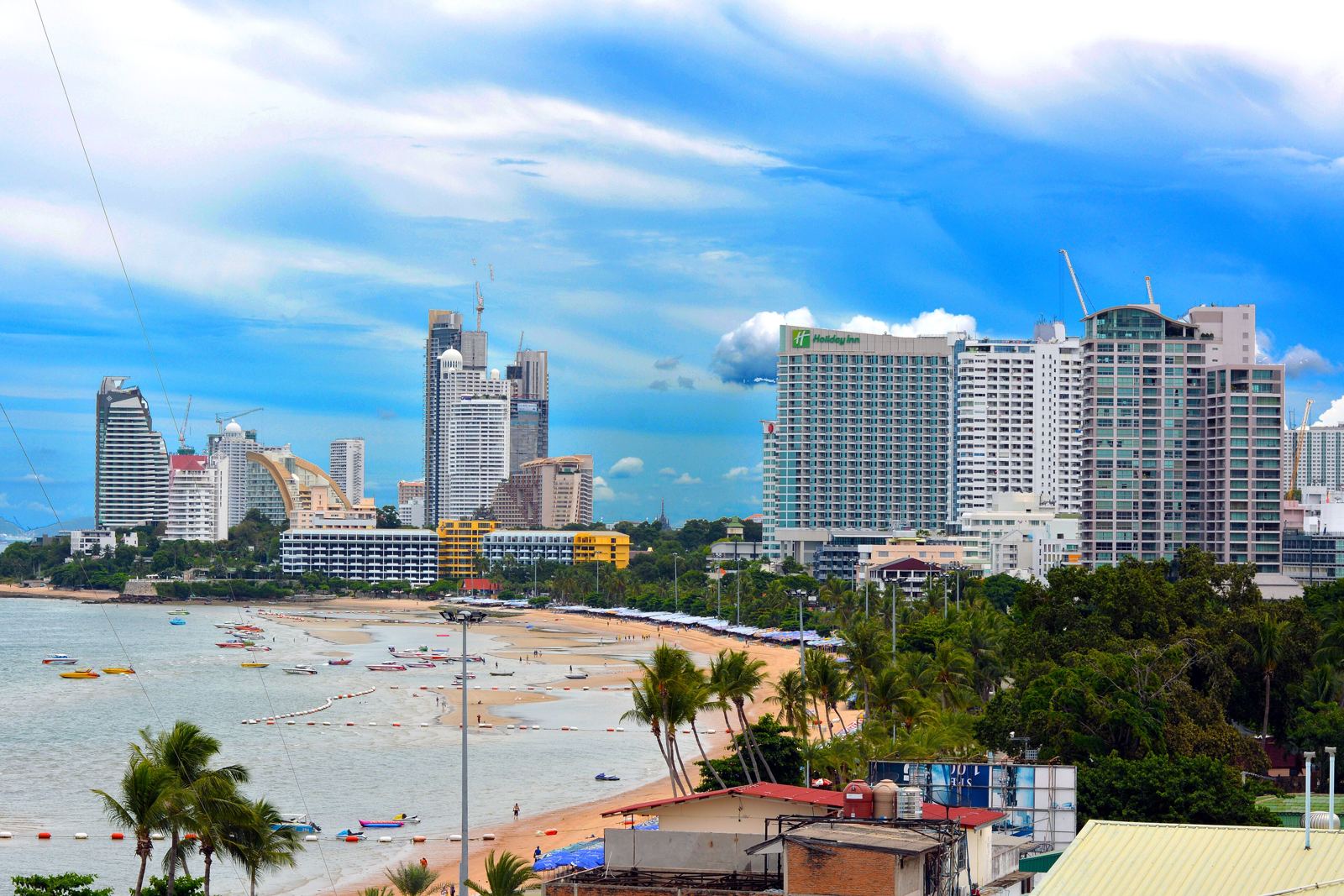
Photo: FritzDaCat · CC BY-SA 4.0
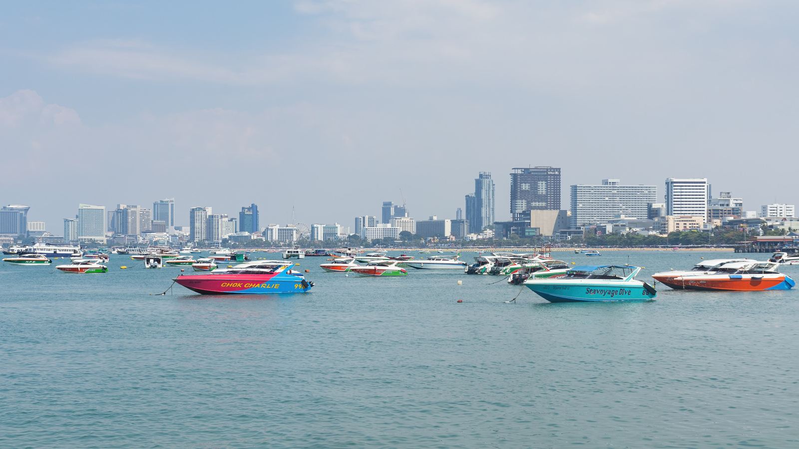
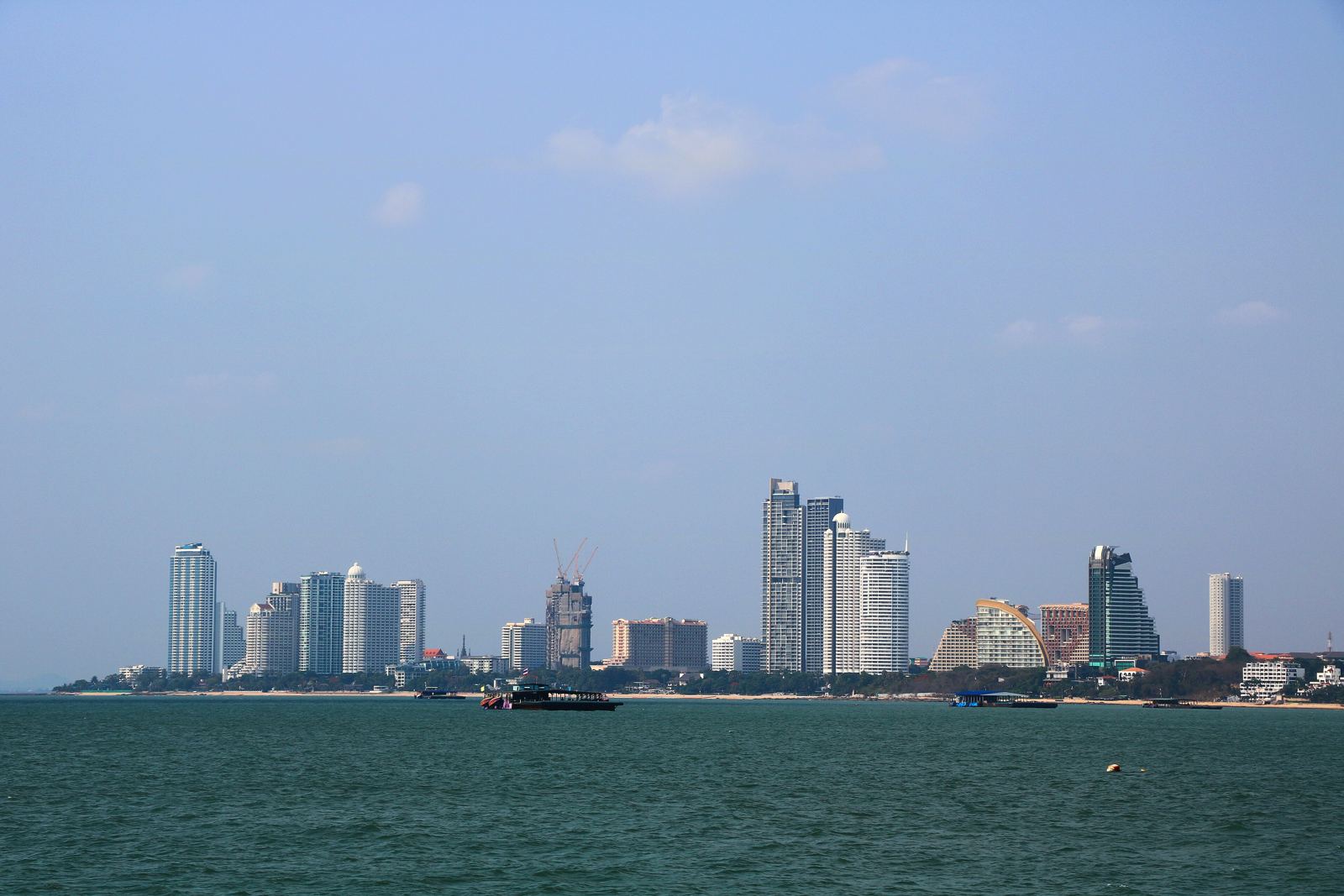
A city on the bay: beach and skyline, Bangkok in roughly one and a half to two hours.
Pattaya lies on the east coast of the Gulf of Thailand, about 150 km south-east of Bangkok, in Chonburi province. The city has grown along the coast over decades and now reaches into every neighbouring sub-district. Where you live therefore shapes quiet, distances and daily life a great deal.
On climate: Wikipedia describes a tropical climate with dry, hot and rainy seasons; in the rainy season flooding occurs – in August 2021 important roads were up to two metres under water. If you can, plan viewings outside the dry season too.
Explore the neighbourhoods
Pick a neighbourhood. You see character, beaches, realities and – from the verified places on this page – what is nearby.
Central Pattaya
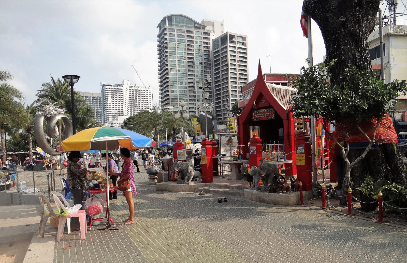
The heart of the city: Beach Road, Second Road and Third Road form the core, with Sukhumvit Road as the main axis to the east. Beach, shopping centres, restaurants and hospitals sit close together.
Atmosphere & daily life
According to Wikivoyage, most places downtown share the same baht-bus route and are only minutes apart. Central Pattaya (the mall) and Royal Garden Plaza stand on the beach, Terminal 21 further north. The southern part with Walking Street (closed to vehicles in the evening) is the nightlife and tourist centre; the middle and northern parts feel more everyday.
Who may feel at home here
Our reading of the sources: people who want city life with short distances to shopping, dining and healthcare and can live with activity around them. Less suited if quiet is the top priority.
Beaches & things to see
- Pattaya Beach – about 2.7 km long, parallel to Beach Road; beach restoration with imported sand began in 2018 because of erosion.
- Walking Street and Bali Hai Pier at the south end (ferries to Ko Lan, about 7 km offshore).
- Terminal 21, Central Pattaya and Royal Garden Plaza as the big shopping destinations.
Good to know – including the realities
- In 2016 the regional environmental office rated sea water off the centre as poor; Naklua, Jomtien and Ko Lan were rated fairly good.
- Wikivoyage names traffic as the biggest hazard – black spots include the Dolphin Roundabout and Beach Road/Central Pattaya Road; most accidents involve motorbikes.
- Heavy monsoon rain can cause flooding: in August 2021 important roads were up to two metres under water (Wikipedia).
Nearby (driving time from the area centre)
International schools
Shopping
Supermarkets
Hospitals
Restaurants & cafés
Connections
Driving times: OSRM (OpenStreetMap road data), without traffic, from the centre point of the area – an estimate, not a timetable. Only places we have verified; the list is not exhaustive.
Our project in Pattaya
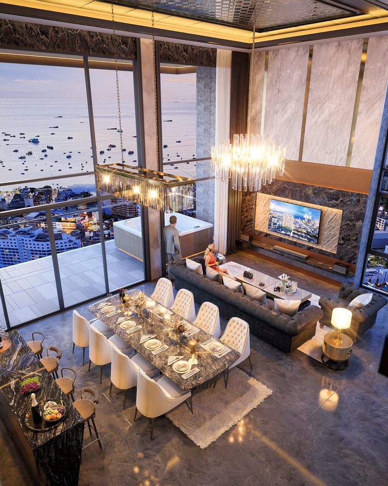
The project is in Pattaya “directly on the bay”. We do not publish the exact neighbourhood here – we share it in a personal conversation.
Interested in Central Pattaya?
Tell us what matters to you about the location. We will check, without obligation, what fits your ideas.
Wongamat / Naklua
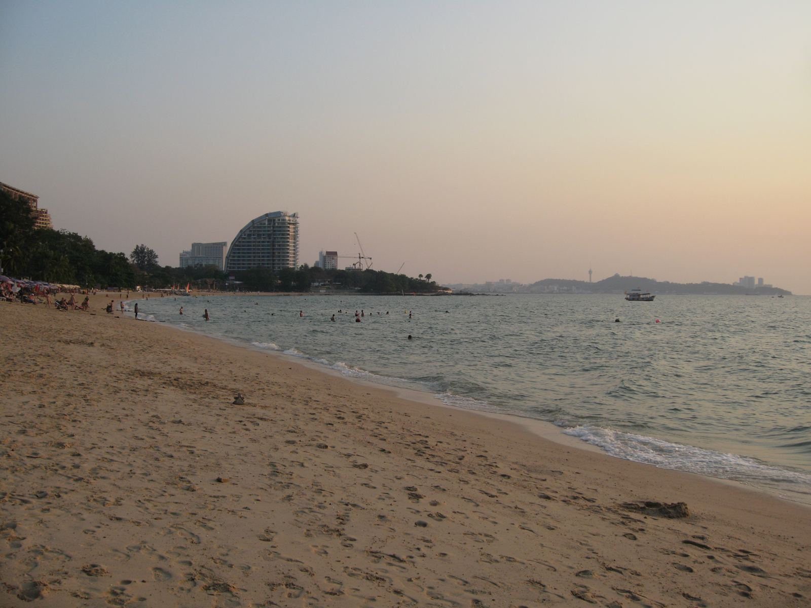
The north of the bay: Naklua lies immediately north of North Pattaya; Wong Amat Beach forms the northern end of Pattaya Bay and is reached via Naklua.
Atmosphere & daily life
Wikivoyage describes Naklua as popular with German-speaking visitors, with quick, cheap baht-bus links to the rest of Pattaya. The beaches (Naklua, Crescent Moon, Palm, Wong Amat, the small Wong Phra Chan) are described as cleaner and quieter than Pattaya Beach. Naklua is home to the Sanctuary of Truth, Lovell International School (early years/primary) and Bangkok Hospital Pattaya on Sukhumvit Road.
Who may feel at home here
Our reading of the sources: people who want to live near the beach but with less bustle than the centre and who value being close to a large private hospital.
Beaches & things to see
- Wong Amat Beach at the north end of the bay; next to it the small, tranquil Wong Phra Chan (about 1 km) and Naklua Beach.
- Sanctuary of Truth at Laem Ratchawet: a huge wooden temple, under construction since 1981 and still unfinished.
- The regional office rated water quality off Naklua as fairly good in 2016.
Good to know – including the realities
- Wikivoyage calls Naklua the smallest and least significant sub-district for tourism – which also makes it quieter; nightlife and shops are fewer than in the centre.
- Wong Amat Beach is reached via Naklua; traffic builds up at the Dolphin Roundabout (the access from the south).
- As elsewhere in Pattaya, flooding in the rainy season is possible (Wikipedia, 2021).
Nearby (driving time from the area centre)
International schools
Shopping
Supermarkets
Hospitals
Restaurants & cafés
Connections
Driving times: OSRM (OpenStreetMap road data), without traffic, from the centre point of the area – an estimate, not a timetable. Only places we have verified; the list is not exhaustive.
Our project in Pattaya
The project is in Pattaya “directly on the bay”. We do not publish the exact neighbourhood here – we share it in a personal conversation.
Interested in Wongamat / Naklua?
Tell us what matters to you about the location. We will check, without obligation, what fits your ideas.
Pratumnak
The Phra Tamnak headland (also Buddha Hill) lies between South Pattaya and Jomtien. At 98 m it is the highest natural point in Pattaya City.
Atmosphere & daily life
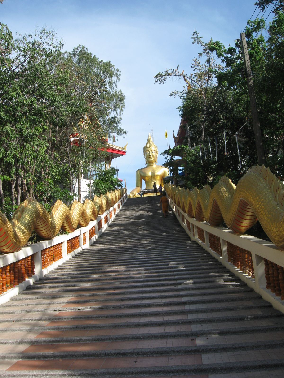
Wikivoyage describes Pratumnak as a quieter part of Pattaya with steep, undulating sois and many high-rise towers and hotels. The hill has Wat Phra Yai (Big Buddha), viewpoints and Chaloem Phrakiat Park; Pattaya Park and Tower stand at the south end, the P.E.A.C.H. convention hall at the north end. Wikipedia mentions large Norwegian colonies on the hill. The coast alternates between several small beaches (Cosy, Pratumnak, Royal Cliff).
Who may feel at home here
Our reading of the sources: people who want a quieter residential area with sea views and a short drive to the city and Jomtien, and who are comfortable with hillside roads and a vehicle.
Beaches & things to see
- Cosy Beach, Pratumnak Beach and Royal Cliff Beach on the west side; Dongtan Beach and Jomtien to the south-east.
- Wat Phra Yai with its 18 m golden Buddha (temple dating from the 1940s) and viewpoints in Chaloem Phrakiat Park.
- Pattaya Park and Tower at the south end; Bali Hai Pier and Walking Street below the hill.
Good to know – including the realities
- Wikivoyage says Pratumnak has no regular baht-bus service – motorbike taxi, regular taxi or the Bolt app are the options.
- Some sois are steep; a vehicle is practically a must.
- The “Waterfront Suites” high-rise (building 2011–2014, halted in 2014) stands unfinished and, per Wikipedia, blocks the view at the summit – an example of how new buildings can change views.
Nearby (driving time from the area centre)
International schools
Shopping
Supermarkets
Hospitals
Restaurants & cafés
Connections
Driving times: OSRM (OpenStreetMap road data), without traffic, from the centre point of the area – an estimate, not a timetable. Only places we have verified; the list is not exhaustive.
Our project in Pattaya
The project is in Pattaya “directly on the bay”. We do not publish the exact neighbourhood here – we share it in a personal conversation.
Interested in Pratumnak?
Tell us what matters to you about the location. We will check, without obligation, what fits your ideas.
Jomtien
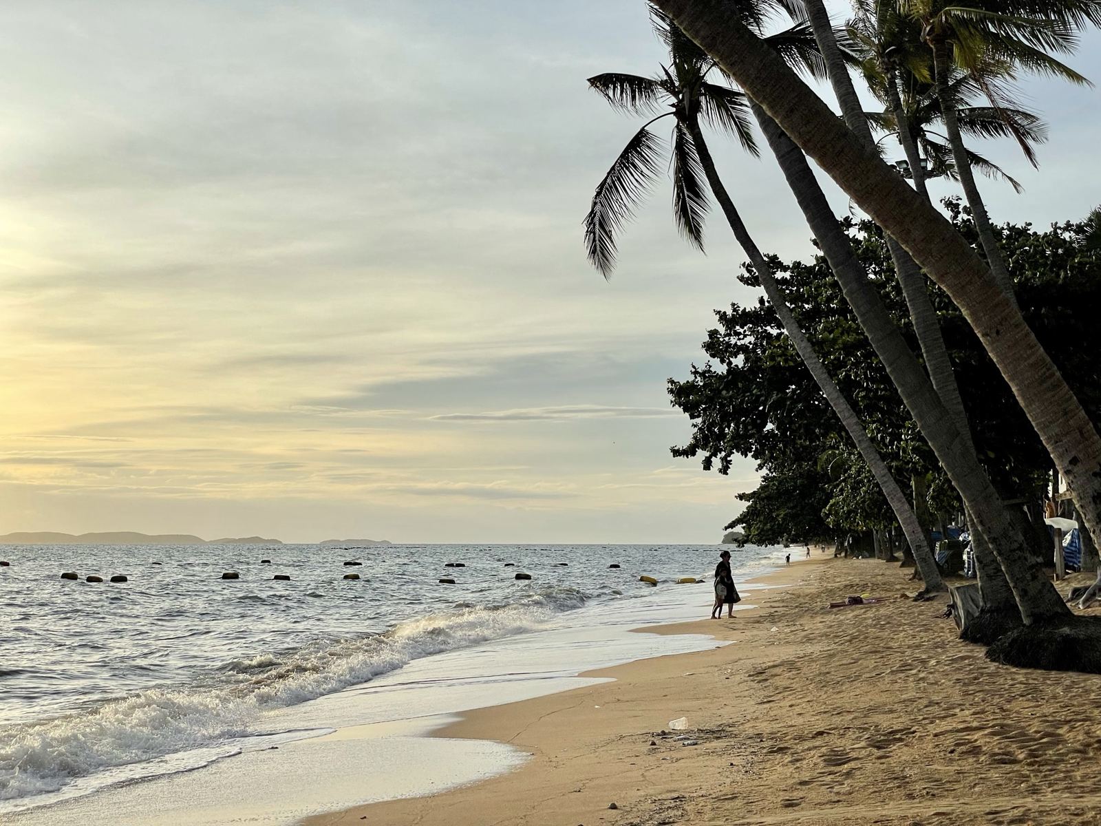
About 3 km south of Pattaya, with a beach of roughly 5–6 km. Jomtien consists of high-rise condominiums, beachside hotels, restaurants and shops.
Atmosphere & daily life
Wikivoyage calls Jomtien a quieter suburb with a significant population of permanent expat retirees; Wikipedia adds that it is popular with Bangkok residents as a second home and with foreign retirees. The beach has a shaded walkway and no hotels directly on the sand. Second Road, Jomtien Market and a complex of shops and restaurants are further focal points. The baht-bus line on Beach Road links Jomtien to Pattaya via Thappraya Road.
Who may feel at home here
Our reading of the sources: people who want to live by the beach long term, prefer a calmer setting than the centre and still value short distances to Pattaya – often retirees and second-home buyers.
Beaches & things to see
- Jomtien Beach – broader and, per Wikivoyage, generally in better shape than Pattaya Beach; swimming zones are separated from motorboats by buoys.
- Dongtan Beach at the northern end, reached via Thappraya Road.
- Underwater World and Pattaya Park are nearby.
Good to know – including the realities
- Wikivoyage notes pockets of beach bars (near the police box, Rompho market) – quiet depends on the stretch.
- Many plots are still undeveloped, so there are fewer tourist attractions and less traffic than in the centre.
- The same caveats on water quality and traffic apply as for the whole city; the rainy season can bring flooding.
Nearby (driving time from the area centre)
International schools
Shopping
Supermarkets
Hospitals
Restaurants & cafés
Connections
Driving times: OSRM (OpenStreetMap road data), without traffic, from the centre point of the area – an estimate, not a timetable. Only places we have verified; the list is not exhaustive.
Our project in Pattaya
The project is in Pattaya “directly on the bay”. We do not publish the exact neighbourhood here – we share it in a personal conversation.
Interested in Jomtien?
Tell us what matters to you about the location. We will check, without obligation, what fits your ideas.
Na Jomtien
South of Jomtien Beach and, according to Wikivoyage, already part of Sattahip district. The area has its own beaches and the Ocean Marina.
Atmosphere & daily life
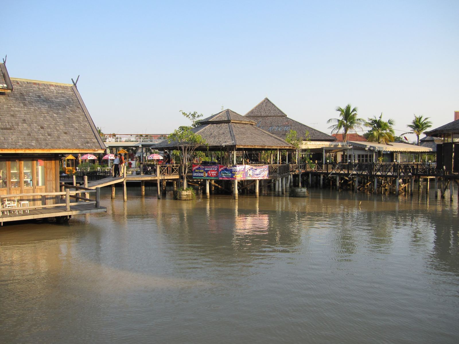
Wikivoyage describes poorer connections to Pattaya; many hotels append “Jomtien” to their names. Jomtien Beach Road runs to the northern edge of Na Jomtien, but public transport goes via Sukhumvit Road. The Pattaya Floating Market is also there. The area is less densely built and therefore quieter; in return, distances to malls, schools and hospitals are longer.
Who may feel at home here
Our reading of the sources: people who value quiet and space, have their own vehicle and are fine with longer journeys into the city. Closer to U-Tapao Airport than the other neighbourhoods.
Beaches & things to see
- North Na Jomtien Beach and South Na Jomtien Beach as the area’s beaches.
- Ocean Marina Yacht Club in Na Jomtien (Wikivoyage lists a sailing school there).
- Pattaya Floating Market on Sukhumvit Road, south of Jomtien.
Good to know – including the realities
- Because the area is part of Sattahip according to Wikivoyage, the responsible authority and infrastructure can differ from Pattaya City – we clarify this per property.
- Public transport is limited; some baht buses turn back before the end of the route.
- The selection of verified places nearby is smaller than in the centre; our data is thinner here.
Nearby (driving time from the area centre)
International schools
Shopping
Supermarkets
Hospitals
Restaurants & cafés
Connections
Driving times: OSRM (OpenStreetMap road data), without traffic, from the centre point of the area – an estimate, not a timetable. Only places we have verified; the list is not exhaustive.
Our project in Pattaya
The project is in Pattaya “directly on the bay”. We do not publish the exact neighbourhood here – we share it in a personal conversation.
Interested in Na Jomtien?
Tell us what matters to you about the location. We will check, without obligation, what fits your ideas.
East Pattaya
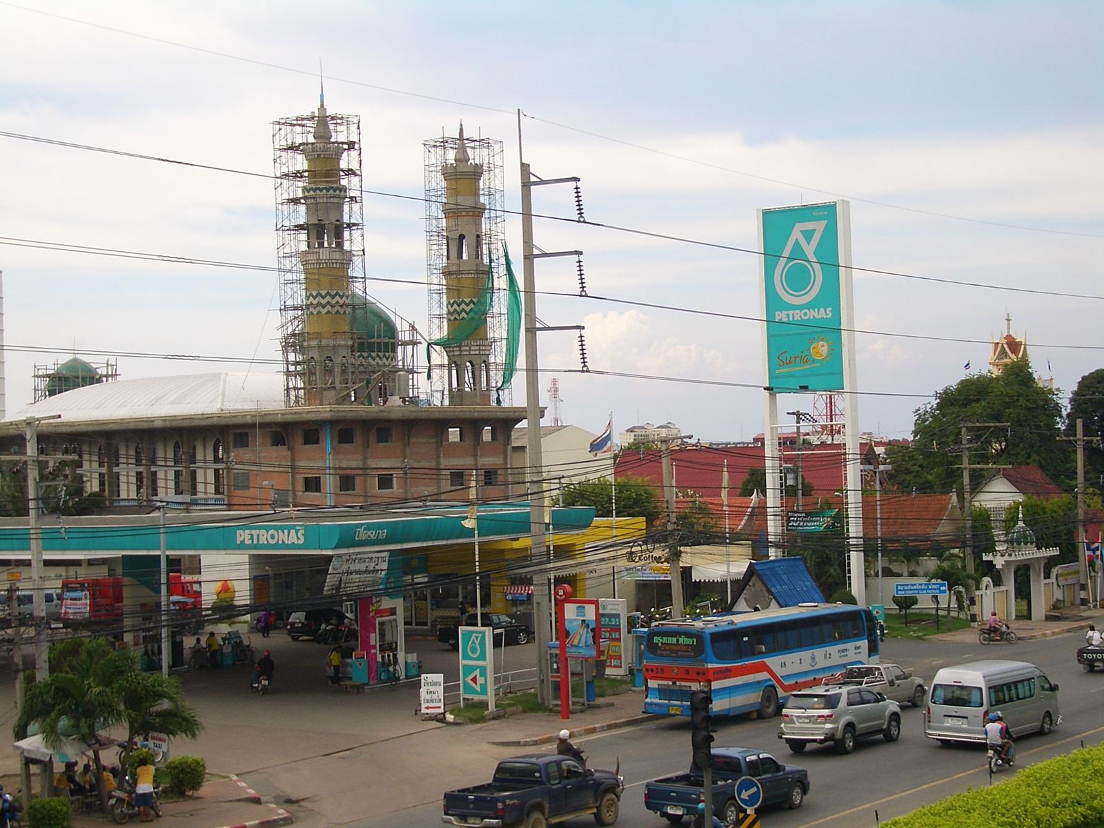
East of Sukhumvit Road and the railway line. Wikivoyage describes the area as mostly residential with few hotels.
Atmosphere & daily life
Much of what serves local daily life is here: bars, restaurants and golf courses; Tara Pattana International School, Pattaya railway station, the North Pattaya bus terminal and a Makro on North Pattaya Road. Further east are Regents International School, the Thai Polo Club and Siam Country Club. Mini Siam stands on Sukhumvit Road. To the centre it is about 5–10 minutes by vehicle according to our routing (no traffic).
Who may feel at home here
Our reading of the sources: people who value space, proximity to schools and golf above beachfront – for example families or long-term residents with their own vehicle.
Beaches & things to see
- No beach in East Pattaya itself; Pattaya Beach and Jomtien are reached by vehicle.
- Mini Siam (miniature replicas of monuments) on Sukhumvit Road.
- Siam Country Club (Old Course and Plantation) and the Thai Polo & Equestrian Club to the east.
Good to know – including the realities
- Without your own vehicle the area is harder to get around than the coastal neighbourhoods.
- Sukhumvit Road is busy; traffic on the main axes can extend journey times considerably.
- The mix is wide: housing estates, commerce and leisure facilities alternate – an on-site visit matters especially here.
Nearby (driving time from the area centre)
International schools
Shopping
Supermarkets
Hospitals
Restaurants & cafés
Connections
Driving times: OSRM (OpenStreetMap road data), without traffic, from the centre point of the area – an estimate, not a timetable. Only places we have verified; the list is not exhaustive.
Our project in Pattaya
The project is in Pattaya “directly on the bay”. We do not publish the exact neighbourhood here – we share it in a personal conversation.
Interested in East Pattaya?
Tell us what matters to you about the location. We will check, without obligation, what fits your ideas.
The map that actually helps
Choose a neighbourhood and categories. Every place is individually verified (OpenStreetMap plus official and editorial sources). Distances are measured from the centre of the chosen neighbourhood – our project is also only placed approximately in Pattaya; we give the exact location on request.
Map: coastline and place data © OpenStreetMap contributors (ODbL). Driving times and routes: OSRM demo server (OpenStreetMap data), free flow without traffic. Map library: Leaflet (BSD-2). No third-party map tiles are loaded.
Your life here – for whom?
Choose what matters to you. The ranking of neighbourhoods comes from driving times to the verified places on this page – not from gut feeling, and not from advertising.
Living in Pattaya with children
For families the key points are the school run, medical care and everyday shopping. Three international schools are verified on the map; more lie in the wider region (Si Racha, Rayong). Fees, places and admission requirements need to be clarified with the schools directly.
- The schools are in the east or in Naklua – the school run is a criterion for where to live.
- Bangkok Hospital Pattaya states a 24-hour emergency centre and helicopter transfer; it lies on Sukhumvit Road.
- Family destinations: Underwater World, Mini Siam, Pattaya Park, Floating Market – often reachable only by vehicle.
Neighbourhoods by these criteria
- 1Central PattayaSchool ≈ 6 min · Hospital ≈ 1 min · Supermarket ≈ 2 minView neighbourhood
- 2East PattayaSchool ≈ 8 min · Hospital ≈ 5 min · Supermarket ≈ 4 minView neighbourhood
- 3Wongamat / NakluaSchool ≈ 3 min · Hospital ≈ 6 min · Supermarket ≈ 5 minView neighbourhood
- 4PratumnakSchool ≈ 11 min · Hospital ≈ 6 min · Supermarket ≈ 4 minView neighbourhood
How we calculate: for each criterion we use the driving time (no traffic, OSRM) from the area centre to the nearest verified place in that category. The rank is the average of the individual ranks – a pointer, not a recommendation. Your everyday life matters more than any table.
A holiday home for a few weeks a year
If you are only there part of the year, beach, airport and dining matter most. Pattaya is the coastal city that is quickest to reach from Bangkok – but the beaches differ a great deal. If you are not on site yourself, someone needs to look after the property – we discuss this openly.
- According to the sources, the beaches in the north (Naklua, Wong Amat) and in Jomtien are quieter and cleaner than Pattaya Beach.
- From Suvarnabhumi Airport it is about 1½ hours (without traffic); U-Tapao is closer but has only limited commercial flights.
- The rainy season (May–November) can bring flooding and rough seas.
Neighbourhoods by these criteria
- 1Central PattayaBeach ≈ 1 min · Suvarnabhumi ≈ 1 h 41 min · Leisure spot ≈ 6 minView neighbourhood
- 2Wongamat / NakluaBeach ≈ 2 min · Suvarnabhumi ≈ 1 h 43 min · Leisure spot ≈ 6 minView neighbourhood
- 3PratumnakBeach ≈ 3 min · Suvarnabhumi ≈ 1 h 45 min · Leisure spot ≈ 5 minView neighbourhood
- 4JomtienBeach ≈ 3 min · Suvarnabhumi ≈ 1 h 46 min · Leisure spot ≈ 5 minView neighbourhood
How we calculate: for each criterion we use the driving time (no traffic, OSRM) from the area centre to the nearest verified place in that category. The rank is the average of the individual ranks – a pointer, not a recommendation. Your everyday life matters more than any table.
Living quietly, well looked after
For a longer stay, healthcare, shopping and surroundings that suit everyday life matter most. Wikivoyage calls Jomtien a quieter place with many permanent retirees. Buying property alone does not generally give a right of residence – see our guide.
- The sources describe Jomtien, Pratumnak, Naklua and Wong Amat as quieter.
- Several hospitals are verified (Bangkok Hospital Pattaya, Pattaya Memorial, Jomtien Hospital, Pattaya International Hospital).
- Public transport is limited in Pratumnak and Na Jomtien.
Neighbourhoods by these criteria
- 1Central PattayaHospital ≈ 1 min · Supermarket ≈ 2 min · Mall ≈ 3 minView neighbourhood
- 2PratumnakHospital ≈ 6 min · Supermarket ≈ 4 min · Mall ≈ 4 minView neighbourhood
- 3East PattayaHospital ≈ 5 min · Supermarket ≈ 4 min · Mall ≈ 6 minView neighbourhood
- 4Wongamat / NakluaHospital ≈ 6 min · Supermarket ≈ 5 min · Mall ≈ 4 minView neighbourhood
How we calculate: for each criterion we use the driving time (no traffic, OSRM) from the area centre to the nearest verified place in that category. The rank is the average of the individual ranks – a pointer, not a recommendation. Your everyday life matters more than any table.
Considering it as an investment
We make no promises about returns or value growth. Instead of a ranking we show what to check before any purchase and which properties are available.
- Ownership for foreigners: condos as freehold within the 49% foreign quota; villas and land usually via leasehold or a company structure – check with independent legal advice.
- Pattaya has many high-rises; check building age, management fees, quota and whether future construction could change the view (example: the unfinished “Waterfront Suites” on Pratumnak).
- Rentability and resale depend on project, location and market and are not guaranteed; clarify the rules on short-term rentals of condos legally in advance.
- Include flood risk in the rainy season and the location relative to Bangkok and the airports in your research.
Matching properties
Areas where we have projects are shown first.
Moving for good
Moving permanently means you need everything: school or work, healthcare, shopping, connections. This selection combines the main everyday criteria. Residency questions (visas) are clarified with the relevant authorities – according to Wikivoyage the immigration office is on Jomtien Beach Road.
- Check visa categories separately – a property purchase alone is generally not enough.
- The centre and the eastern parts are best served (from the verified places); in Na Jomtien the distances are longer.
- Plan a trial stay on site before buying.
Neighbourhoods by these criteria
- 1Central PattayaSchool ≈ 6 min · Hospital ≈ 1 min · Supermarket ≈ 2 min · Mall ≈ 3 minView neighbourhood
- 2Wongamat / NakluaSchool ≈ 3 min · Hospital ≈ 6 min · Supermarket ≈ 5 min · Mall ≈ 4 minView neighbourhood
- 3East PattayaSchool ≈ 8 min · Hospital ≈ 5 min · Supermarket ≈ 4 min · Mall ≈ 6 minView neighbourhood
- 4PratumnakSchool ≈ 11 min · Hospital ≈ 6 min · Supermarket ≈ 4 min · Mall ≈ 4 minView neighbourhood
How we calculate: for each criterion we use the driving time (no traffic, OSRM) from the area centre to the nearest verified place in that category. The rank is the average of the individual ranks – a pointer, not a recommendation. Your everyday life matters more than any table.
How you get around
Pattaya sits between Bangkok and two airports. Choose two places; the driving times are estimates from OpenStreetMap road data (OSRM) without traffic, and real journeys can take considerably longer – especially to and from Bangkok.
From Suvarnabhumi Airport
| Neighbourhood | Driving time (estimate) | Distance |
|---|---|---|
| East Pattaya | ≈ 1 h 24 min | 120 km |
| Central Pattaya | ≈ 1 h 26 min | 123 km |
| Wongamat / Naklua | ≈ 1 h 27 min | 122 km |
| Pratumnak | ≈ 1 h 29 min | 126 km |
| Jomtien | ≈ 1 h 30 min | 127 km |
| Na Jomtien | ≈ 1 h 32 min | 131 km |
From U-Tapao Airport
| Neighbourhood | Driving time (estimate) | Distance |
|---|---|---|
| Na Jomtien | ≈ 49 min | 34 km |
| Jomtien | ≈ 53 min | 40 km |
| East Pattaya | ≈ 57 min | 45 km |
| Central Pattaya | ≈ 58 min | 45 km |
| Pratumnak | ≈ 58 min | 45 km |
| Wongamat / Naklua | ≈ 1 h 01 min | 48 km |
From Bangkok (centre)
| Neighbourhood | Driving time (estimate) | Distance |
|---|---|---|
| East Pattaya | ≈ 1 h 37 min | 141 km |
| Central Pattaya | ≈ 1 h 39 min | 144 km |
| Wongamat / Naklua | ≈ 1 h 40 min | 143 km |
| Pratumnak | ≈ 1 h 42 min | 147 km |
| Jomtien | ≈ 1 h 43 min | 148 km |
| Na Jomtien | ≈ 1 h 45 min | 152 km |
Sources sometimes quote slightly different distances (Wikivoyage: Suvarnabhumi about 110 km, Wikipedia: about 120 km); ours are calculated and do not replace a timetable. Public options: buses from Bangkok (Mo Chit, Ekkamai, Southern Terminal) to the North Pattaya bus terminal, an airport bus from Suvarnabhumi (Wikipedia: about 1½ hours) and a State Railway of Thailand train; check departure times and fares with the operators – some Wikivoyage details are older.
Daily life – honestly looked at
A property is only one part. What counts is how everyday life feels. Here is what we can say reliably – with advantages and drawbacks. We deliberately quote no prices: sources differ and go out of date quickly.
Groceries & supermarkets
Pattaya has big chains (Big C, Lotus’s, Tops, Makro) as well as Friendship Supermarket, Foodland and Villa Market, which stock imported goods. Terminal 21 has a supermarket and a food court, Tukcom a Tops in the basement. The map shows the verified branches with driving time.
International education
Verified are Regents International School Pattaya (Nord Anglia, ages 2–18, campus in Pong), Tara Pattana International School (English curriculum, International Schools Partnership) and Lovell International School (early years/primary in Naklua). More schools lie in the wider region, for example in Si Racha and Rayong.
Healthcare
Wikivoyage mentions several hospitals and dentists of a high standard at reasonable cost. Verified are Bangkok Hospital Pattaya (24-hour emergency, helicopter transfer), Pattaya Memorial Hospital, Jomtien Hospital and Pattaya International Hospital.
Cost of living
How expensive life is depends heavily on lifestyle: condo management fees, electricity (air conditioning), transport, health insurance, school and food. We deliberately quote no averages because sources differ widely and go out of date quickly.
Transport
Daily life runs on baht buses (songthaews) on fixed routes, motorbike taxis, taxis and ride-hailing (Wikivoyage names the Bolt app). A “Beach Bus” line runs in a circle as far as the Floating Market according to Wikivoyage. Buses to Bangkok leave from the North Pattaya bus terminal, and a State Railway of Thailand train links Pattaya station to Bangkok.
Family life
Underwater World (an aquarium with tunnels over 105 m long), Mini Siam, Pattaya Park with its water park, the Floating Market, the Sanctuary of Truth and Nong Nooch Tropical Garden are the verified family destinations. Jomtien’s beaches have swimming zones marked off with buoys.
Dining & cafés
The offer is international: Italian (Prego, Toscana), seafood and Thai (Breezeo), Thai classics such as Mae Sri Ruen and many European cuisines. The map shows only venues we have verified.
Fitness & wellness
Golf (Siam Country Club with Old Course and Plantation), polo and riding at the Thai Polo & Equestrian Club, water sports on the beach as well as muay Thai and fitness gyms (Wikivoyage lists several). On the map the golf and polo facilities are verified.
Weekends & day trips
Ko Lan lies about 7 km offshore; ferries leave from Bali Hai Pier at the south end of Walking Street. Bangkok is reachable in about 1½–2 hours. Wikivoyage points out that many “Pattaya” attractions are actually in Jomtien, Sattahip and Si Racha.
Local life
Pattaya has an international character: Wikipedia mentions newspapers in English, Russian, German and Norwegian, and there are large communities, for example Norwegian and Russian. At the same time, everyday Thai life continues in the eastern neighbourhoods.
Practical points for foreigners
Foreigners can buy condos as freehold (within the 49% quota); villas and land follow other structures. According to Wikivoyage the Pattaya Immigration Office is on Jomtien Beach Road. Banks and ATMs are widespread; fees on foreign cards are high, so a local account is worth considering (Wikivoyage). Details in the guide.
Our project in Pattaya
In Pattaya we currently show the tower residence with sea view. We give the exact location in a personal conversation; prices, availability and details are on the property page.
Pattaya in mind? Let’s talk about it.
Start your enquirySources & credits
We only write what we can back up. Individual statements come from Wikipedia, Wikivoyage (CC BY-SA, some older text), the operators of the places and the pages listed in the source list; opinions (“may suit”) are our reading of these sources. Data checked on 1 November 2026.
Photos
- Pattaya Bay: FritzDaCat · CC BY-SA 4.0 · Wikimedia Commons
- Pattaya: Don Ramey Logan · CC BY-SA 3.0 · Wikimedia Commons
- Pattaya: iMahesh · CC BY-SA 4.0 · Wikimedia Commons
- Beach Road: Георгий Долгопский · CC BY-SA 4.0 · Wikimedia Commons
- Pattaya: Wayne77 · CC BY-SA 4.0 · Wikimedia Commons
- Wong Amat Beach: Георгий Долгопский · CC BY-SA 4.0 · Wikimedia Commons
- Naklua Beach: KAI LARS SCHERER · CC BY 3.0 · Wikimedia Commons
- Naklua: Supanut Arunoprayote · CC BY-SA 4.0 · Wikimedia Commons
- Khao Phra Tamnak: ICOLEF / visualtravelguide.com · CC BY-SA 4.0 · Wikimedia Commons
- Wat Phra Yai: Ruslik0 · CC BY-SA 4.0 · Wikimedia Commons
- Jomtien Beach: Георгий Долгопский · CC BY-SA 4.0 · Wikimedia Commons
- Jomtien Beach: Slyronit · CC BY-SA 4.0 · Wikimedia Commons
- Pattaya Floating Market: Jonashtand · CC BY-SA 4.0 · Wikimedia Commons
- Pattaya Floating Market: Horiuchi · Public domain · Wikimedia Commons
- Mini Siam: Jonashtand · CC BY-SA 4.0 · Wikimedia Commons
- Sukhumvit Road: Vmenkov · CC BY-SA 4.0 · Wikimedia Commons
Map & routing
Map: coastline and place data © OpenStreetMap contributors (ODbL). Driving times and routes: OSRM demo server (OpenStreetMap data), free flow without traffic. Map library: Leaflet (BSD-2). No third-party map tiles are loaded.